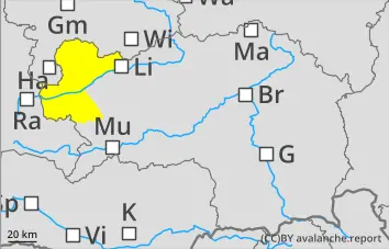
The avalanche risk is moderate above 1,800 metres and low below that. Furthermore, there remains a problem with old snow in the wider northern sector. In steep gullies and hollows, medium-sized snow slab avalanches can still be triggered by people. The hazardous areas are usually difficult to spot and are often located in transition zones between areas with little snow and those with a lot.
On very steep slopes facing east, south or west, the likelihood of wet-snow avalanches being triggered increases slightly as the day progresses.
On steep terrain, there is a risk of falling on the hard snow surface.
Snowpack
Radiation is somewhat reduced from the second half of the night onwards. Consequently, the snow surface often only consolidates slightly and, on the sun-facing side, may become increasingly soft depending on the amount of solar radiation. On the shaded side, at higher altitudes there are still areas with a loose (angular) snow surface; in some places, the firmness of the snowpack there varies depending on altitude and aspect. Beneath this lies a snowpack that is becoming increasingly well-settled and compact, though the transition to the base layer – consisting of deep hoar (floating snow) – remains poor. Mid-altitude (sunny) and lower elevations are largely snow-free.
Tendency
Friday and Saturday will be fairly sunny and dry. As the wind shifts to the south-west, there will be some Föhn-like conditions. There will be little change in the avalanche risk.
Danger Level 2 — Moderate
Danger rating
treeline
Avalanche Problem
New snow
Treeline
no specific warning
Latent problem with old snow; slightly increasing problem with wet snow
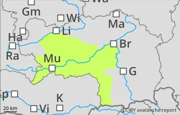
The avalanche risk is low. However, there remains a problem with old snow in the wider northern sector. In isolated cases, particularly in very steep gullies and hollows, snow slab avalanches may be triggered by people. The hazardous areas are usually difficult to spot and are often located in transition zones where snow cover varies from light to heavy.
On sunny slopes, the likelihood of small wet-snow avalanches being triggered increases slightly as solar radiation intensifies.
On steep terrain, there is a risk of falling on the hard snow surface.
Snowpack
Overnight radiation can lead to the formation of a crust, which softens on the sun-facing side during the day as moisture penetrates deeper. On the shaded side, at higher altitudes, there are still isolated areas with a loose (angular) snow surface; in some places, the firmness of the snowpack varies depending on altitude and aspect. Beneath this lies a snowpack that is becoming increasingly well-settled and compact, though the transition to the base layer – consisting of deep hoar (floating snow) – remains poor. Mid- and low-altitude areas are often snow-free.
Tendency
Friday and Saturday will be fairly sunny and dry. As the wind shifts to the south-west, there will be some Föhn-like conditions. There will be little change in the avalanche risk.
Danger Level 1 — Low
Danger rating
Avalanche Problem
Persistent weak layer
Treeline
The old snow cover consists of transformed snow crystals.
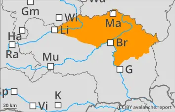
The avalanche risk above 1,800 metres is still assessed as moderate. Wet, loose-snow avalanches from slopes that have not yet been unloaded remain possible.
In the northern sector, there is still a problem with old snow: in very steep, north-facing gullies and hollows, dry snow slab avalanches may be triggered by significant additional loading.
Snowpack
During the night, the snowpack regains some of its strength. However, it loses this strength again due to solar radiation. Even at high altitudes, the snowpack has become wet, damp or hard, depending on the aspect. On the north-facing slopes at high altitudes, the snowpack continues to be weakened by metamorphic processes (old snow problem).
Tendency
High-pressure conditions are set to continue on Sunday. The wind will be from the south. No significant change in the avalanche risk is expected.


 Treeline


 1000m